Temporary Test Page
This is size 18px.....which can be chosen from the Text Basics toolbar.
This is size 14pt.....which has to be coded into the HTML or else imported from cut-and-paste content.
This is size 20px.....which can be chosen from the Text Basics toolbar.
This is size 20px in BOLD.
This is size 28 (regular and bold)
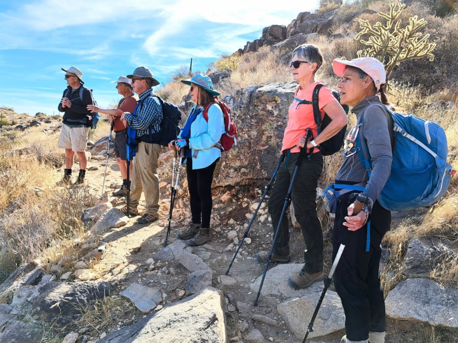
"A" Hike Descriptions
"A" Hike Descriptions
The heading immediately below here is an H1 element.
"A" Hike Descriptions
The heading immediately above here is an H1 element.
"A" Hike Descriptions
"A" Hike Descriptions
This is size 36 (regular and bold)
I LIKE SIZE 36 NOT BOLD!
What follows is an excerpt from the Word doc A Hike Descriptions for Spring 2026. It is currently "fully justified" right and left. I'm going to see if doing "Align Left" within Ionos looks any different from doing "Align Left" in Word before I copy it to Ionos.
2025-12-27 results: The align-left works the same in Word and Ionos, and it doesn't mess up the two-column sections. But working in Word is easier than working in Ionos. So in Word, I left-align the entire document, then go back to re-center the dividing lines after each hike. Then I copy it all and paste it into Ionos.
Before changing alignment:
Hike Description: This is an A+ hike because of the high AEG and longer mileage. This route follows established but rocky trails. There are multiple ascents and descents to beautiful Le Barge Canyon where high narrow canyon walls and water flowing through pools in smooth rock make for an excellent destination and lunch spot. Hiking sticks are strongly recommended for multiple water crossings.
AllTrails: First Water Loop via LaBarge Canyon
Driving Instructions: Drive north on 99th Avenue. Turn right on Bell Road to Loop 101. Turn left on Loop 101 North. Stay on Loop 101 going around the north and then the east side of town to Highway 60 East. Take Highway 60 East to Idaho Road. Turn north on Idaho Road (Highway 88) and follow north for 2.2 miles. Highway 88 angles right just past Scenic Street and Idaho Road continues north. Go right and stay on Highway 88. Follow Highway 88 for 5.2 miles to the signed turnoff for First Water Trailhead which is FR 78. Turn right on FR 78 and follow 2.6 miles to Dutchman's Trailhead (Google Maps).
TH GPS: 33.480056, -111.443083
After aligning-left in Ionos:
Hike Description: This is an A+ hike because of the high AEG and longer mileage. This route follows established but rocky trails. There are multiple ascents and descents to beautiful Le Barge Canyon where high narrow canyon walls and water flowing through pools in smooth rock make for an excellent destination and lunch spot. Hiking sticks are strongly recommended for multiple water crossings.
AllTrails: First Water Loop via LaBarge Canyon
Driving Instructions: Drive north on 99th Avenue. Turn right on Bell Road to Loop 101. Turn left on Loop 101 North. Stay on Loop 101 going around the north and then the east side of town to Highway 60 East. Take Highway 60 East to Idaho Road. Turn north on Idaho Road (Highway 88) and follow north for 2.2 miles. Highway 88 angles right just past Scenic Street and Idaho Road continues north. Go right and stay on Highway 88. Follow Highway 88 for 5.2 miles to the signed turnoff for First Water Trailhead which is FR 78. Turn right on FR 78 and follow 2.6 miles to Dutchman's Trailhead (Google Maps).
TH GPS: 33.480056, -111.443083
Aligned left in Word before pasting into Ionos:
Hike Description: This is an A+ hike because of the high AEG and longer mileage. This route follows established but rocky trails. There are multiple ascents and descents to beautiful Le Barge Canyon where high narrow canyon walls and water flowing through pools in smooth rock make for an excellent destination and lunch spot. Hiking sticks are strongly recommended for multiple water crossings.
AllTrails: First Water Loop via LaBarge Canyon
Driving Instructions: Drive north on 99th Avenue. Turn right on Bell Road to Loop 101. Turn left on Loop 101 North. Stay on Loop 101 going around the north and then the east side of town to Highway 60 East. Take Highway 60 East to Idaho Road. Turn north on Idaho Road (Highway 88) and follow north for 2.2 miles. Highway 88 angles right just past Scenic Street and Idaho Road continues north. Go right and stay on Highway 88. Follow Highway 88 for 5.2 miles to the signed turnoff for First Water Trailhead which is FR 78. Turn right on FR 78 and follow 2.6 miles to Dutchman's Trailhead (Google Maps).
TH GPS: 33.480056, -111.443083
DOUBLE-CHECK that Align Left in Ionos doesn't mess up the two-column upper part of each hike. (It probably will mess up the centering of the line between hikes.)
Before changing alignment:
Day: Friday, January 30 Hike: A+
Trail Name: Le Barge Canyon via First Water Location: Superstition Mountains
Assemble at: Bell Rec. Ctr. Leave at: 7:00 AM
Driving Distance(RT): 145 Road Conditions: All paved except last 3 miles
Elevation Change: 1100’ Hiking Distance(RT): 11.5
Accumulated Elevation Gain: 1700'
Leaders: Mark Scott 541-678-2666 Holly Scott 541-389-8494
After aligning-left in Ionos:
Day: Friday, January 30 Hike: A+
Trail Name: Le Barge Canyon via First Water Location: Superstition Mountains
Assemble at: Bell Rec. Ctr. Leave at: 7:00 AM
Driving Distance(RT): 145 Road Conditions: All paved except last 3 miles
Elevation Change: 1100’ Hiking Distance(RT): 11.5
Accumulated Elevation Gain: 1700'
Leaders: Mark Scott 541-678-2666 Holly Scott 541-389-8494
Hike Description: This is an A+ hike because of the high AEG and longer mileage. This route follows established but rocky trails. There are multiple ascents and descents to beautiful Le Barge Canyon where high narrow canyon walls and water flowing through pools in smooth rock make for an excellent destination and lunch spot. Hiking sticks are strongly recommended for multiple water crossings.
AllTrails: First Water Loop via LaBarge Canyon
Driving Instructions: Drive north on 99th Avenue. Turn right on Bell Road to Loop 101. Turn left on Loop 101 North. Stay on Loop 101 going around the north and then the east side of town to Highway 60 East. Take Highway 60 East to Idaho Road. Turn north on Idaho Road (Highway 88) and follow north for 2.2 miles. Highway 88 angles right just past Scenic Street and Idaho Road continues north. Go right and stay on Highway 88. Follow Highway 88 for 5.2 miles to the signed turnoff for First Water Trailhead which is FR 78. Turn right on FR 78 and follow 2.6 miles to Dutchman's Trailhead (Google Maps).
TH GPS: 33.480056, -111.443083
_____________________________________________________________________________
This is Heading 2
Trying to insert a smiling emoji at the end of bullet 1 (see below attempts)
Assembly Location and Time: Assemble at Bell Recreation Center as follows:
- A and C hikers meet at 8 a.m. Make sure you are in the right group.
- B hikers meet at 8:15 a.m.
Lunch: Something new for the fall.
Assembly Location and Time: Assemble at Bell Recreation Center as follows:

- A and C hikers meet at 8 a.m. Make sure you are in the right group.
THIS IS A TEST! DID THIS EDIT GET SAVED???
Larry Bickell is our A level Hike Leader of the Year.
Donney Speck is our B level Hike Leader of the Year.
Beth Smith is our C level Hike Leader of the Year.
In the Images tool, this photo shows up as rotated 90 degrees counter-clockwise. But when I choose it for this element, Ionos turns it right side up.
Daisy Mountain B Hike

Heading
This is a text! You can edit, move, copy or delete it.
TO FIX WHO'S WHO (CLUB OFFICERS) THAT ENDS UP WITH FONT COLOR CHANGES AND VERTICAL LINE SPACING CHANGES AFTER PASTING FROM WORD DOCUMENT INTO AN IONOS PAGE:
1) Make these changes in the Word document:
a) Set all content to have font color Black
b) Set all the position/name lists (i.e., NOT the titles like Board of Directors, etc.) to have Line Spacing of "Multiple / 1.1".
2) Create a new page, name it Club Officers New, and make it a Hidden page, with NO sidebar.
3) Near the top of the page (below the logo and tabs), change the word Heading to Club Officers
4) Add an element of Text Box.
5) Copy the entire Word document and paste it into the Text Box.
6) Make adjustments in each line's spaces to get the columns even. Save the page.
7) Hide the older page, then rename it from Club Officers to Club Officers Old. IMPORTANT: Password-protect this page under its new name! Keep it for a short time for comparison purposes, then delete it when you are happy with the new page.
8) Rename the newer page from Club Officers New to Club Officers
9) IMPORTANT: Password-protect the page! The upper section of the password protection page will show "Club Officers" with the password, but you also need to check the checkbox for this page in the lower section.
10) UN-Hide the page (and if necessary, move it into its correct position just above Financials / Meeting Minutes).
Examples of pasting from Word and PDF:
Pasted from the Bulletin Word document:
Day: Tuesday, February 6 Hike: A+
Trail Name: Le Barge Canyon via First Water Location: Superstition Mountains
Assemble at: Bell Rec. Ctr. Leave at: 7:30 AM
Driving Distance(RT): 145 Road Conditions: All paved except last 3 miles
Elevation Change: 1100’ Hiking Distance(RT): 11.5
Accumulated Elevation Gain: 2335'
Leaders: Susan Lehman (319) 330-1392, Cathie Spain (404) 275-2709
Pasted from the Bulletin PDF: (Notice spaces on each line are collapsed into 1)
Day: Tuesday, February 6 Hike: A+
Trail Name: Le Barge Canyon via First Water Location: Superstition Mountains
Assemble at: Bell Rec. Ctr. Leave at: 7:30 AM
Driving Distance(RT): 145 Road Conditions: All paved except last 3 miles
Elevation Change: 1100’ Hiking Distance(RT): 11.5
Accumulated Elevation Gain: 2335'
Leaders: Susan Lehman (319) 330-1392, Cathie Spain (404) 275-2709
Who's Who examples:
Pasted from MS Word:
Board of Directors
President Debbie Frank 480-825-5219 president@suncityhikers.org
Vice President Joette Conger 630-390-8571 vicepresident@suncityhikers.org
Treasurer Karol Mabe 602-403-5114 treasurer@suncityhikers.org
Secretary Dianne Haberman 970-275-9067 secretary@suncityhikers.org
Hike Chairperson Rod Frank 269-270-4398 rod.frank602@gmail.com
Membership Chairperson Nancy Andersen 623-297-3786 membership@suncityhikers.org
Tech Team Representative Dave Conklin 406-210-4989 techteamrep@suncityhikers.org
Pasted from PDF: (Notice spaces on each line are collapsed into 1)
Board of Directors
President Debbie Frank 480-825-5219 president@suncityhikers.org
Vice President Joette Conger 630-390-8571 vicepresident@suncityhikers.org
Treasurer Karol Mabe 602-403-5114 treasurer@suncityhikers.org
Secretary Dianne Haberman 970-275-9067 secretary@suncityhikers.org
Hike Chairperson Rod Frank 269-270-4398 rod.frank602@gmail.com
Membership Chairperson Nancy Andersen 623-297-3786 membership@suncityhikers.org
Tech Team Representative Dave Conklin 406-210-4989 techteamrep@suncityhikers.org
Using the Advanced / Paste from Word feature (but pasting into a box on a dialog box): (Results are the same as pasting directly from Word)
Board of Directors
President Debbie Frank 480-825-5219 president@suncityhikers.org
Vice President Joette Conger 630-390-8571 vicepresident@suncityhikers.org
Treasurer Karol Mabe 602-403-5114 treasurer@suncityhikers.org
Secretary Dianne Haberman 970-275-9067 secretary@suncityhikers.org
Hike Chairperson Rod Frank 269-270-4398 rod.frank602@gmail.com
Membership Chairperson Nancy Andersen 623-297-3786 membership@suncityhikers.org
Tech Team Representative Dave Conklin 406-210-4989 techteamrep@suncityhikers.org